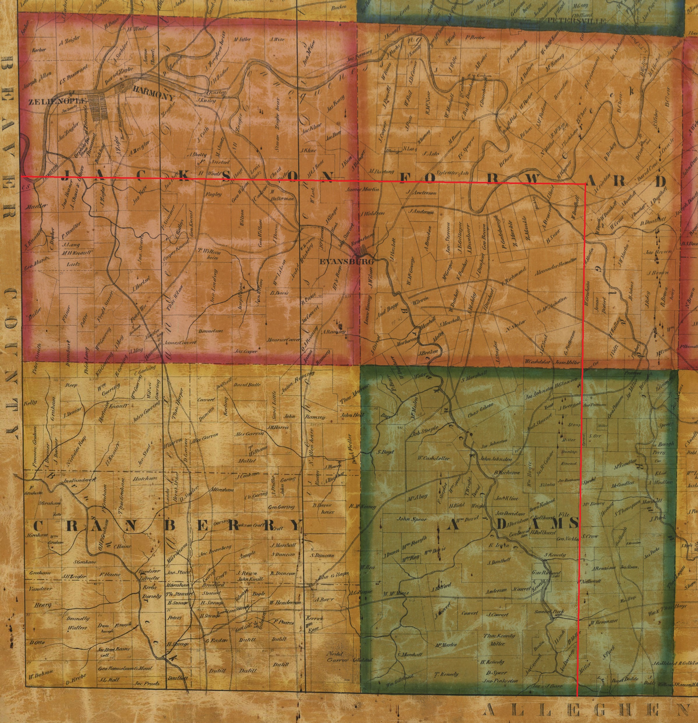
This is the Cranberry Township portion of the 1858 Butler County Map. If you are doing research of Cranberry Township Prior to 1854, you may find residents of Cranberry that became residents of Adams, Forward or Jackson in 1854. These maps have been included for that reason. They are very helpful when reviewing census records as well. Click the images to view them on a new page and zoom in. (Mobile devices may not need to do this.)
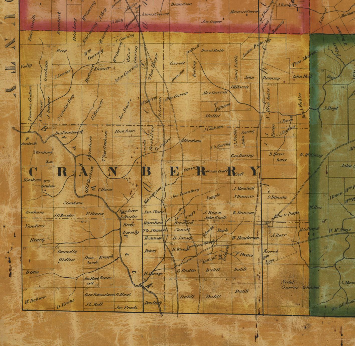
Below is a composite map that stitches together Adams, Cranberry, Forward and Jackson Township, which went together fairly nicely with no modifications. Post 1854, Butler County is 5 townships wide, equal in width east to west. Using pixel measurements, a township in pixels x 5 / 3 = the width of the townships across Butler county, when 3 wide. This new dimension minus the old dimension allowed for a fairly accurate calculation of the former east boundary of Cranberry Township. There happen to be many natural property lines on the Adams map and a full-length line was drawn in red to indicate the eastern boundary of Cranberry Township before Adams, Forward and Jackson were formed in 1854. A township boundary map (to be posted) indicated that half of Jackson Township came from Cranberry. With this in mind, additional property lines are shown in this location on the map and those lines were used to draw a northern boundary of Cranberry before the 1854 division. This composite map is not survey accurate and is only presented as a rough guide. This map can be helpful when reviewing a US census for Cranberry Township from 1810 to 1850. On 12 March 1804, Butler county subdivided from 4 townships to 13 townships. For 4 years, Cranberry Township was the southern part of Connoquennessing Township. From 24 September 1788 to 12 March 1800, Butler County was part of Allegheny County. In 1785, Westmoreland County gained the land acquired from the Purchase of 1784, making the area comprising Cranberry Township part of Westmoreland County. A review of the Depreciation Lands surveys, performed in the summer of 1785, indicates Westmoreland County.