Map Room
Maps to add (All of these can be found elsewhere online):
1800 Township Boundaries
1804 Township Boundaries
1850 Township Boundaries
1892 Depreciation Lands Map
1941 Butler County
1959 Butler County
Maps to add (All of these can be found elsewhere online):
1800 Township Boundaries
1804 Township Boundaries
1850 Township Boundaries
1892 Depreciation Lands Map
1941 Butler County
1959 Butler County
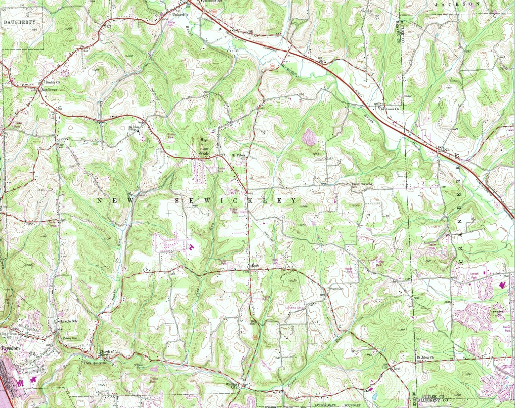
This is a 1953 map photo updated in 1969. The 1969 updates are purple. Click the image for the full-size 11.5 mb PDF version.
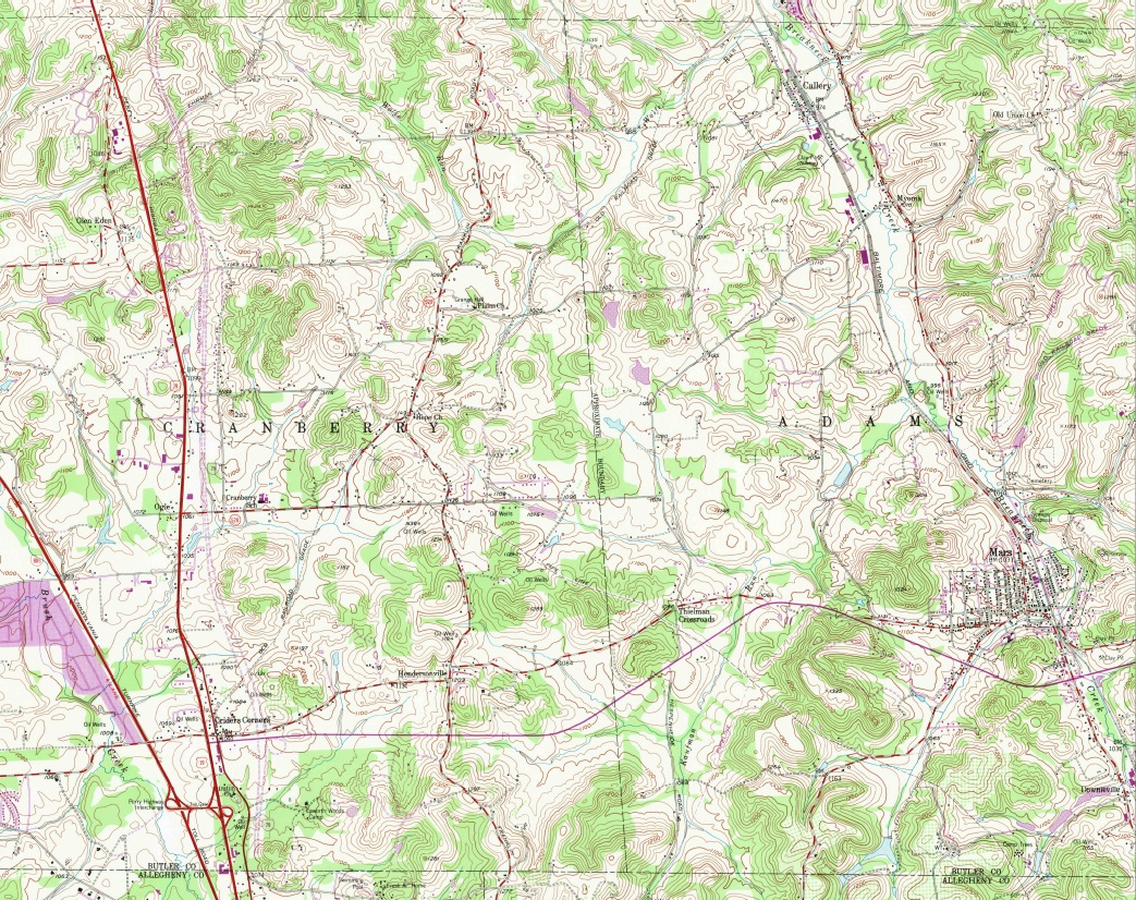
This is a 1953 map photo updated in 1979. The 1979 updates are purple. Click the image for the full-size 12.2 mb PDF version.
This is a 1960 map that is part of the CTHS collection. The map is the size of 4 sheets of 8.5 x 11 paper and has been neatly folded. The map was scanned into 4 jpgs, then assembled in an image editing program and printed to PDF. We will be looking into having the map scanned on a larger machine to have a one-piece scan. Click the image to view or download the 2.24 mb PDF file.
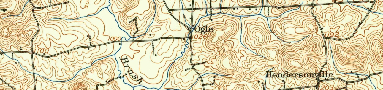
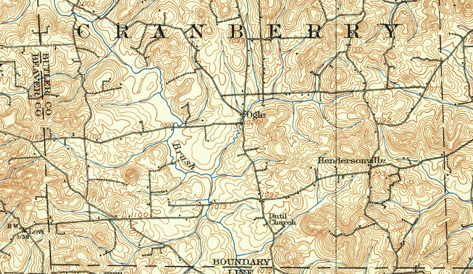
This is the 1908 Sewickley 15 Minute Quad. The survey occurred in 1906, so the Harmony Line does not appear. Click the map image to download the 11.1 Mb map in PDF format.
This is the Cranberry Township map of 1874. If you are doing research of Cranberry Township Prior to 1854, you may find residents of Cranberry that became residents of Adams, Forward or Jackson in 1854. These maps have been included for that reason. They are very helpful when reviewing census records as well. Click the image to view it on a new page.
This is the Cranberry Township portion of the 1858 Butler County Map. If you are doing research of Cranberry Township Prior to 1854, you may find residents of Cranberry that became residents of Adams, Forward or Jackson in 1854. These maps have been included for that reason. They are very helpful when reviewing census records as well. Click the images to view them on a new page and zoom in. (Mobile devices may not need to do this.)
This is the Adams Township portion of the 1858 Butler County Map. If you are doing research of Cranberry Township Prior to 1854, you may find residents of Cranberry that became residents of Adams in 1854. This map has been included for that reason. It can be very helpful when reviewing census records as well. Click the image to view it on a new page and zoom in.
This is the Forward Township portion of the 1858 Butler County Map. If you are doing research of Cranberry Township Prior to 1854, you may find residents of Cranberry that became residents of Forward in 1854. This map has been included for that reason. It can be very helpful when reviewing census records as well. Click the image to view it on a new page and zoom in.
This is the Jackson Township portion of the 1858 Butler County Map. If you are doing research of Cranberry Township Prior to 1854, you may find residents of Cranberry that became residents of Jackson in 1854. This map has been included for that reason. It can be very helpful when reviewing census records as well. Click the image to view it on a new page and zoom in.
This is the Forward Township map of 1874. If you are doing research of Cranberry Township Prior to 1854, you may find residents of Cranberry that became residents of Forward in 1854. This map has been included for that reason. It can be very helpful when reviewing census records as well. Click the image to view it on a new page.
This is the Adams Township map of 1874. If you are doing research of Cranberry Township Prior to 1854, you may find residents of Cranberry that became residents of Adams in 1854. This map has been included for that reason. It can be very helpful when reviewing census records as well. Click the image to view it on a new page.
This is the Jackson Township map of 1874. If you are doing research of Cranberry Township Prior to 1854, you may find residents of Cranberry that became residents of Jackson in 1854. This map has been included for that reason. It can be very helpful when reviewing census records as well. Click the image to view it on a new page.
The first map is cropped from the second. This map zooms in to show the proposed B.P. & C. RR passing through Cranberry Township, crossing an unnamed proposed railroad in the northwest corner of the township. These railroads were likely to be involved in the steel industry. Neither was built. The unnamed railroad connected the point in Pittsburgh to New Castle, a steel town. The B.P. & C RR connected Sharpsburg to Rock Point, a large source of limestone.